


Forecasters Say El Niño Is Coming. The 'Super' Label Is Premature.
NOAA, WMO and ECMWF agree the Pacific is tipping into El Niño. They don't yet agree on how strong it gets, and a forecasting blind spot is the reason why.

The equatorial Pacific is heating up fast, and the world's major climate agencies now agree that El Niño is on the way. What they don't agree on is whether 2026 delivers another 'super' event of the kind last seen a decade ago.
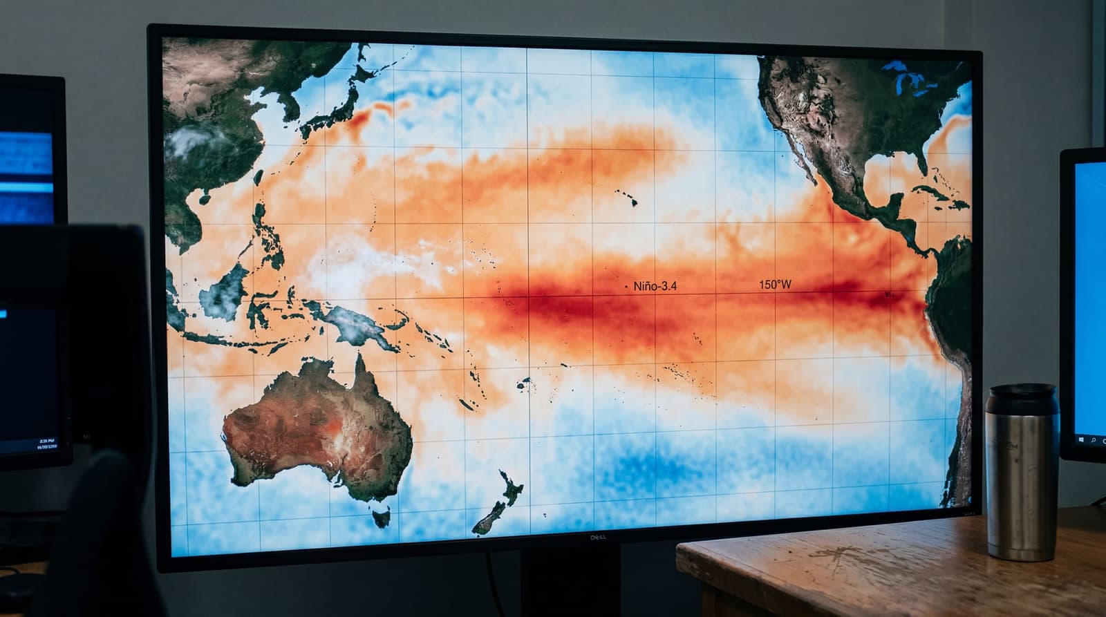
The BBC World Service's Inside Science programme reported this week that sea-surface temperatures in the central and eastern Pacific are climbing rapidly, with subsurface waters running as much as 6°C above average in places. The US National Oceanic and Atmospheric Administration (NOAA) has placed its Climate Prediction Center on El Niño Watch, putting the chance of onset between May and July at 82%, rising to 96% by the November–January window, according to the agency's latest ENSO discussion.
The International Research Institute for Climate and Society (IRI) at Columbia University goes further, putting the odds at 98% through to early 2027. Weekly temperature anomalies in the bellwether Niño-3.4 region reached +0.9°C as of 13 May, the institute said in its May plume update, and the Southern Oscillation Index has fallen to -11.2, a sign the Pacific's Walker circulation is weakening on cue.
What the agencies actually agree on
Onset is the easy call. Intensity is not.
The World Meteorological Organization (WMO) said this month that climate models are 'strongly aligned' on El Niño emerging through the boreal summer, but warned against reading too much into peak-strength projections at this point in the year.
Wilfran Moufouma Okia, Chief of Climate Prediction, WMO
That barrier is well known to forecasters. ENSO prediction skill collapses in March, April and May because the coupled ocean–atmosphere system is in transition and small errors compound quickly. The WMO is expected to issue an updated outlook in late May, once that window has closed.
NOAA's own forecasters have been careful with the 'super' label. The agency currently puts the chance of a 'very strong' event, defined as a Niño-3.4 anomaly above 2°C, at just 37%. The chance of either a strong or very strong event in the November–January peak window sits around two-in-three, NOAA told ABC News.
El Niño depends on the tropical Pacific ocean and atmosphere interacting in a way that reinforces the event. For example, we need to see weaker than average trade winds along the equatorial Pacific Ocean because that will help keep the ocean surface temperatures above average.
Michelle L'Heureux, ENSO forecast lead, NOAA Climate Prediction Center
The European Centre for Medium-Range Weather Forecasts (ECMWF) ensemble is the source of the boldest numbers in circulation. Its April run spans Niño-3.4 anomalies from a tepid 0.2°C to a remarkable 3.3°C by late summer, with a central estimate suggesting waters could reach 3°C above average by November. That spread, not the top of the range, is the story.
Why the headline number matters less than it used to
NOAA quietly shifted last year to the Relative Oceanic Niño Index, or RONI, which strips out the steady background warming of the global oceans before classifying an event. The change matters. The 2023–24 El Niño peaked at a raw anomaly of about 1.69°C, but its atmospheric response, the actual rearrangement of global weather patterns, was weaker than that number implied. A lot of the warmth was just the planet's new baseline.
That lesson is shaping how scientists talk about 2026. A 3°C anomaly in absolute terms is not the same animal as a 3°C anomaly was in 1997 or even 2015.
Friederike Otto, the Imperial College London climate scientist who co-leads World Weather Attribution, told Climate Home News that the underlying trend is the dominant signal regardless of how this particular event resolves.
"The records will still be broken because of human-induced climate change and the continued burning of fossil fuels," Otto said.
NOAA NCEI data show 2024 finished as the warmest year on record at 1.55°C above pre-industrial levels, with the previous El Niño contributing to the spike. Forecasters now put the chance of 2026 ranking in the top five warmest years at around 96%.
The impacts forecasters are watching
Whatever the eventual peak number, an El Niño of even moderate strength reshuffles weather across roughly half the planet. The expected pattern this year includes:
- Drought in eastern Australia, Indonesia and parts of southern Asia
- Heavier rainfall in the Horn of Africa and southern South America
- Suppressed Atlantic hurricane activity, with a corresponding boost in central and eastern Pacific cyclones
- Lower water levels in the Panama Canal watershed, with knock-on disruption to global shipping
- Elevated wildfire risk in already drought-stressed regions
That last item is drawing particular concern. Wildfires have already burned more than 150 million hectares globally since the start of 2026, roughly double the figure for the same period in 2024, according to Euronews.
"A strong El Niño can have a major effect on wildfire risk later in the year," Theodore Keeping, a wildfire researcher at Imperial College London, told the outlet.
The last comparable analogue, the 2015–16 super El Niño, was followed by a record-shattering 2016 globally, mass coral bleaching across the Great Barrier Reef and severe drought across southern Africa and Southeast Asia. The 2023–24 event, despite its weaker atmospheric fingerprint, still drove drought across southern Africa and catastrophic flooding in southern Brazil.
What to watch next
The WMO's late-May update will be the first major forecast issued after the spring predictability barrier lifts, and is likely to narrow the ECMWF ensemble's wide spread. NOAA's June ENSO discussion will follow.
For now, the agencies are united on the shape of the next 12 months and split on the magnitude. As NOAA's Climate Prediction Center put it: "While some model forecasts indicate the possibility of stronger conditions later in the year, there is currently no consensus or sufficient confidence to confirm or exclude a high-intensity event."
The 'super El Niño' framing makes for a sharp headline. The forecasters issuing the underlying numbers are not yet willing to write it.
Related stories
Northern Ireland's rarest rainforest gets a 100-year reboot in Tyrone
Ulster Wildlife has planted nearly 30,000 native trees at Lenamore Wood, the first Northern Irish site in Aviva's £38.9m Celtic Rainforest programme. The genetic detail matters more than the photo op.
Four Jersey beaches flunk bacteria tests as island bakes in record May heat
Officials blame rainfall runoff for 'poor' water quality at Plemont, Grouville, Havre des Pas and Victoria Pool, even as Jersey breaks its all-time May temperature record.
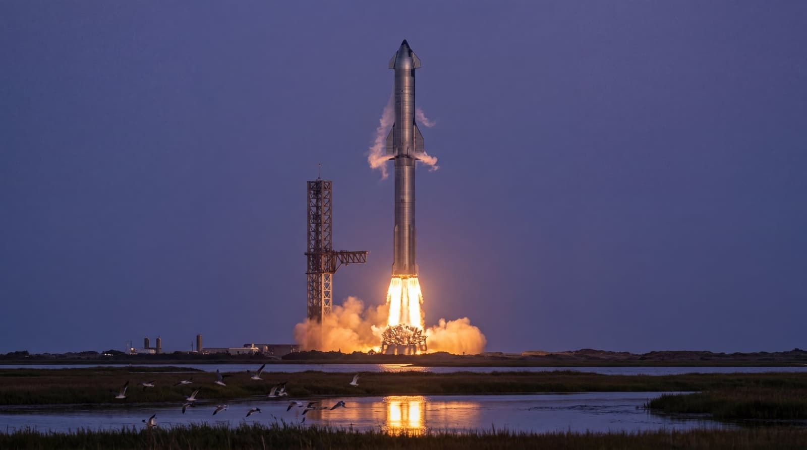
SpaceX's Starship V3 ends in planned Indian Ocean fireball, two days after $80B IPO filing
Flight 12 broke a seven-month launch drought and delivered most of its test goals. The timing, just 48 hours after SpaceX's S-1 hit the SEC, gave the spectacle a second audience: Wall Street.
Somerset's fox count just doubled in 10 days. That's a problem.
A county citizen science project logged more red foxes in a week and a half than official records typically capture in two years, exposing a structural blind spot in how Britain monitors its most familiar wildlife.
Keep Reading
Assyrian Christian Among 85,000 Prisoners Released in Iran Amid Coronavirus Pandemic

UK's River Wye gets a rights charter. Will polluters notice?

The race to shrink the astronaut gym before Mars

Six eggs used to cost £1. Here's why they're now £2.

In Cambridge, a paycheck no longer keeps workers out of the food bank